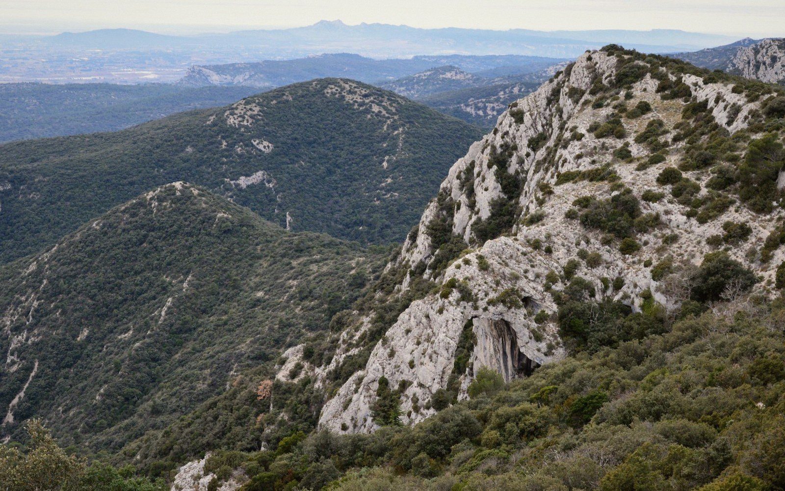
The traverse of the Petit Luberon plateau from the Cavaillon end to the Mourre Nègre side earns its reputation: long, exposed, rewarding, and best attempted with time to spare.
What You Are Walking Into
The Luberon massif divides cleanly at the Lourmarin combe — the natural passage through the rock that the village of Lourmarin occupies. To the west of that gap lies the Petit Luberon, lower and more intimate than its eastern counterpart, its plateau planted in cedar and garrigue rather than stripped bare by altitude. To the east lies the Grand Luberon, which climbs to Mourre Nègre at 1,125 metres. The full traverse discussed here keeps to the Petit Luberon's western half and then continues east, using the ridge as a spine — walking above the Calavon valley on the northern side and the Durance plain on the south, with the two faces trading prominence as the path curves and rises and drops.
It is a genuine commitment. Done in one go, with approach and descent included, you are looking at somewhere between seven and nine hours of actual walking, depending on your start point, pace, and how many times you stop to find your bearings where the Petit Luberon plateau opens into confusing cedar corridors. It is not technical, but it is long, and several sections involve stone underfoot with no gentle way to negotiate ankle height. It is the kind of walk that benefits from a two-car arrangement — start one at the western end near Cheval-Blanc or Cavaillon, leave the other at a descent point above Bonnieux, Lourmarin, or further east.
The Western Opening, the Middle Stretch, and What the Ridge Gives You
The western approach from the Cavaillon side begins gently. The massif is lower here — the plateau sits at around 700 to 750 metres above sea level — and the scrubland is open enough that Cavaillon, below to the north, stays visible for the first hour or so. The soil underfoot changes early: limestone rubble in the garrigue, then denser earth where the cedars begin. This western portion of the route is where most walkers feel best — legs fresh, the scale of the day still abstract — and it is genuinely the easiest terrain. The GR 97 and other long-distance footpaths run across parts of this massif, and waymarking on the western section is reliable enough that you rarely need to count on instinct alone.
The middle stretch, roughly between the high points that overlook Ménerbes and Bonnieux to the north, is where the day becomes its own thing. The cedar forest above Bonnieux — planted in the nineteenth century as a reforestation project, not indigenous — absorbs sound and light in a way that makes the open garrigue feel distant. You are moving through something denser, cooler, and more enclosed. Navigation is less obvious here, and the path sometimes vanishes into needle-covered ground before re-emerging slightly to the left of where you expected. Staying oriented requires occasional attention to the sun and to the shape of the ground falling away to either side.
What the ridge gives you, when the trees thin, is a sense of the massif's logic. The Calavon — the river that runs east–west along the northern foot of the Luberon — is visible below, a line of poplars and willows threading through pale fields. Above Ménerbes and Bonnieux the perched villages are not romantic abstractions from up here; they look structural, functional, anchored to their spurs precisely because the ground demanded it. To the south the Durance plain is wider and less distinct, the irrigated orchards and greenhouse structures reading as industry rather than landscape. Between those two views the ridge is quiet. Even in July, once you are an hour above any trailhead, you will pass other walkers infrequently.
The descent options mid-route matter. Above Bonnieux, a path drops north and is steep in its final section; above Lourmarin, the descent is through open country and is, in clear conditions, straightforward. Neither is a bail-out to be taken lightly — both add real time, and both bring you to a valley floor from which you will need onward transport. Anyone planning the traverse in sections should note this clearly: there is no flat escape from the ridge once you are on it. The terrain commits you.
The Eastern End and What the Traverse Demands
As the ridge curves east toward the Lourmarin gap, the character of the walk changes. The plateau narrows, the cedars thin, and the path becomes more exposed. This eastern section is where the Petit Luberon starts to feel less like a forested plateau and more like a true ridge walk — narrower underfoot, more sky, longer sight lines in every direction. The high point of the Petit Luberon proper, before the Lourmarin combe interrupts the massif, is around 700 metres, lower than Mourre Nègre on the Grand Luberon side but enough altitude to feel the mistral seriously if the day turns. Wind is the exposure that most walkers underestimate on this traverse. Rain and cold are seasonal, and anyone walking in autumn or spring knows to carry a layer. The wind is there in August too, and the ridge offers no shelter when it runs hard from the northwest.
The eastern descent — into the Lourmarin gap or toward Cucuron and the southern flank — is the natural end of the Petit Luberon section. To continue beyond this point is to begin an entirely different undertaking: the Grand Luberon, with its higher, barer terrain, is another day's walk. The traverse of the Petit Luberon alone is complete and self-contained as a route, and treating the Lourmarin gap as the finish line rather than a midpoint is the right call for most parties.
What the route demands, taken in full, is preparedness without complexity. There is no technical climbing, no scrambling, no specialist equipment required in good conditions. What is required: enough water for a full day without resupply, food, reliable footwear that handles loose stone, navigation that does not depend exclusively on phone signal (absent across most of the plateau), and an honest assessment of fitness before departure rather than after. The waymarked GR trails provide the backbone, but the middle sections of the plateau are not reliably marked, and the forest can disorient experienced walkers who trust landmarks that disappear into the canopy.
The fire-risk closures that affect Luberon walking in summer apply to this massif. Parts of the plateau are formally closed during periods of high fire danger — typically at the height of summer — and the closures are not advisory. A traverse attempted during a closure period is both illegal and genuinely dangerous. Check the prefecture's current restrictions before setting out in July or August; this is not bureaucratic caution but practical necessity on a limestone massif covered in dry cedar resin and garrigue in full summer condition.
The rhythm of the traverse, when conditions are right, is one of the most coherent walking days the Luberon offers: a long arc from the agricultural edge of the Cavaillon plain, through the planted forest, across the exposed ridge, and down into the combe with the two villages that define the Lourmarin valley floor below. You see the massif from the inside, which is the only angle from which its scale makes sense. The villages you have looked at from the ridge — Ménerbes, Bonnieux, Oppède — are comprehensible in a way they are not from below. The traverse earns that view by making you work for it.