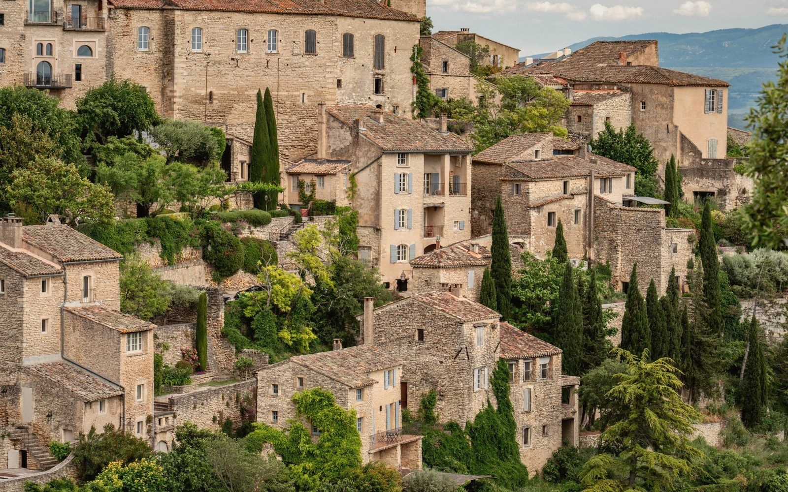
Altitude is the first thing to understand about any Luberon village
The Luberon's villages are not distributed randomly across the landscape. They occupy specific zones on the massif, and those zones determine almost everything: how cold the wind blows in January, how long tomatoes ripen, what stone the houses are built from, and whether the lane to the summit is a pleasant walk or a genuine ordeal. Altitude is the key, and most visitors never quite read it consciously — they see a perched village and admire the view without registering what it actually costs to live there through a cold Provençal winter.
The massif sits at the northern limit of what could reasonably be called a Mediterranean climate. That qualification matters. Below about 300 metres, on the valley floors and southern-facing lower slopes, the climate is mild enough to support olives, early stone fruit, and vines that ripen several weeks ahead of sites higher up. Above 600 metres, on the exposed ridgelines and plateau, you are in a different country altogether — treeless on the Grand Luberon's summit, wind-scoured, occasionally snow-covered for days at a time. The villages are arranged across this gradient, each one legible once you know what to look for.
The three broad zones, and what they mean on the ground
The lowest zone — valley floor and lower slopes, roughly 100 to 300 metres — is where altitude ceases to dominate character. Lourmarin sits at around 230 metres in the natural gap that divides the Petit and Grand Luberon, and the mildness is perceptible: its market square carries café life later into the autumn than anywhere on the ridge, its street trees are larger and more varied, and the agricultural calendar around it begins earlier. Ansouis, on the southern flank, occupies a similar thermal register — sheltered, southward-angled, genuinely warm for most of the year. These villages look the way people imagine Provence looks: golden light, wide views across the Durance plain, lavender in the garden rather than clinging to the cliff.
The stone changes here too. Lower villages draw from local quarries at valley level, where limestone is paler and the mortar between courses is laid more freely, less tightly than it needs to be in exposed positions higher up. The overall palette is warm, almost honey-coloured, and the walls are thicker than climate strictly requires — a residue of defensive logic from centuries past, but not a hardship in the way that wall thickness becomes at altitude.
The middle zone, roughly 300 to 500 metres, is where most of the massif's famous perched villages actually sit. Bonnieux is around 430 metres at its lower terrace; Lacoste is somewhat lower; Ménerbes and Oppède-le-Vieux occupy comparable bands on the western Petit Luberon. These are the villages whose silhouettes define the massif in the popular imagination — the clustered houses stepping up toward a ruined castle or a Romanesque church, the whole thing visible from ten kilometres away across the valley. Here the position was chosen for defence rather than convenience, and the stone reflects it: tighter jointing, darker limestone, walls that have weathered to a cooler grey on their north faces. The mistral — the cold, dry northerly wind that funnels off the Rhône valley — reaches these villages with real force. A winter morning in Bonnieux, with the mistral running and the temperature several degrees below what the valley floor shows, is not mild Provence. It is something considerably more bracing.
The growing season in this band shortens noticeably compared to the valley floor. Vines at this elevation ripen later — sometimes meaningfully so — and frost is a genuine risk in April, which it scarcely is at 200 metres. The plateau above these villages is close enough to feel: from the upper terraces of Bonnieux the cedar forest is directly overhead, and in December the treeline carries snow that has long since melted from the valley.
The upper zone begins above around 500 to 600 metres — the plateau itself and the rare structures that were ever built near the summit. Almost nothing is permanently inhabited up here now. The plateau of the Petit Luberon, planted with cedar and scrub oak over a limestone base, carries the remnants of shepherd shelters, the corbelled dry-stone huts known as bories, and the odd seasonal barn. The Grand Luberon's highest point, Mourre Nègre at 1,125 metres, is bare, cold, and utterly treeless — a reminder that the massif, for all its Mediterranean identity, reaches into genuine upland conditions. The fire-risk closures that apply to the forests in high summer are another expression of this verticality: the higher and drier parts of the massif are dangerous in a way the valley floor simply is not.
Why this matters for understanding individual villages
The altitudinal logic explains several things that visitors often find puzzling. Why does Gordes feel harder and sterner than Lourmarin, despite being roughly comparable in size and visitor numbers? Because Gordes sits above 400 metres on the north face of the Petit Luberon, exposed to a wind regime that the southern villages simply do not experience in the same way. The north face receives less direct sun, and the cold is sharper and longer. The stone there is greyer, the village more closed-in, the streets narrower — not for any aesthetic reason, but because the conditions demanded it.
Why do wine estates on the southern lower slopes taste different from those on the elevated north-facing terraces? Because the altitude difference corresponds directly to a temperature difference, a difference in wind exposure, and a difference in the length of time between flowering and harvest. The same grape variety, grown at 200 metres on the sun-facing southern plain versus 450 metres on the plateau edge, will produce structurally different wine — and the altitude gradient is the clearest explanation for that gap.
The ochre country around Roussillon sits at around 300 metres and occupies a kind of thermal sweet spot — warm enough for a long season, elevated enough to feel properly placed on the massif rather than merely at its foot. The geology there, the exposed ochre cliffs and pigmented soils, is itself a product of the altitudinal position: the erosion that reveals the coloured strata happens most dramatically at mid-slope, where water action and the absence of flat alluvial deposition allow the material to stay exposed.
Reading a village's altitude is not a traveller's trick or a geographer's abstraction. It is the fastest way to understand why a place looks the way it does, feels the way it feels on a February afternoon, and produces what it produces in the fields below.