The accident of ochre
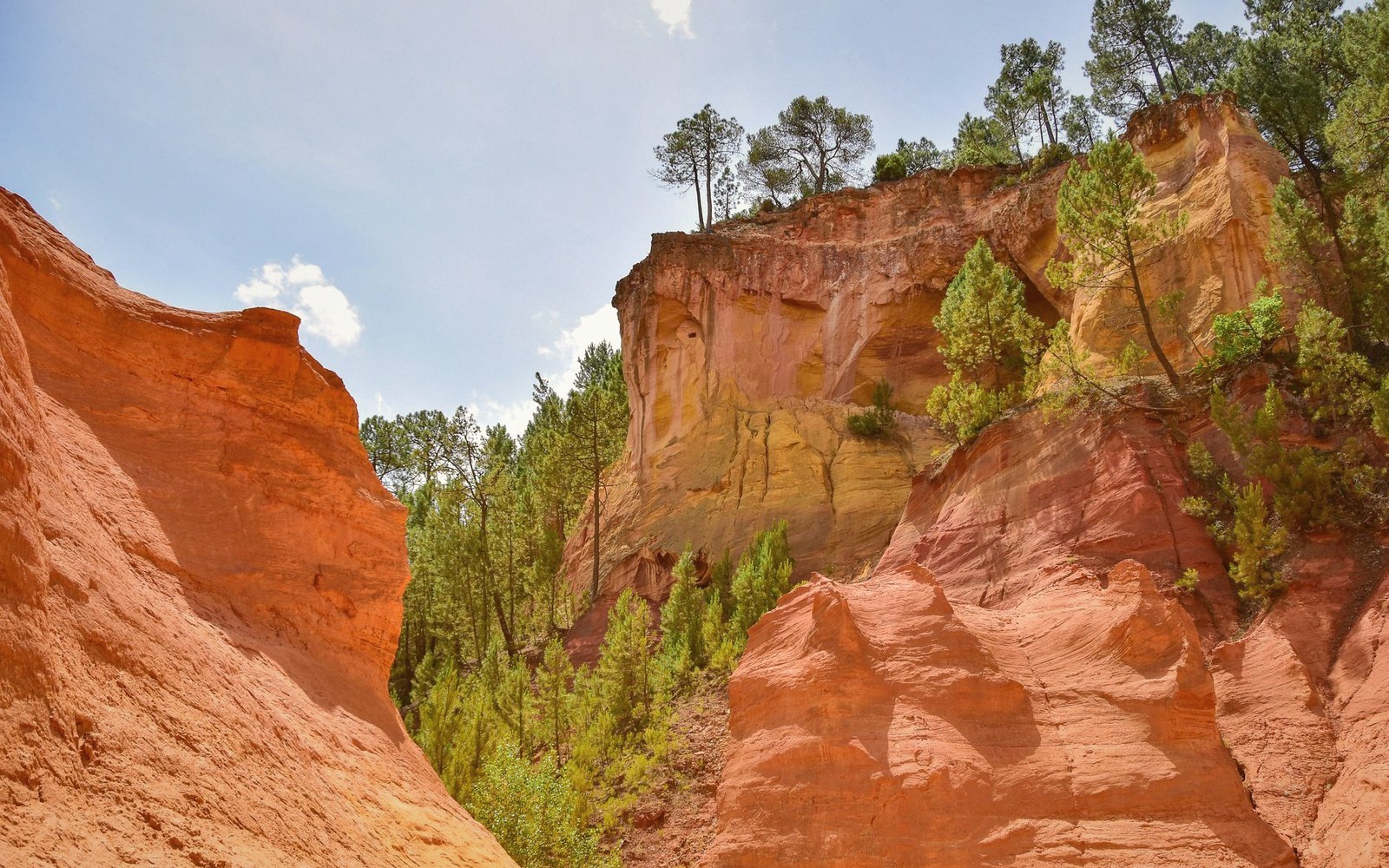
Roussillon sits on one of the largest deposits of ochre-bearing earth in Europe, and it shows. The village itself is red-orange, built from the same pigmented sandstone it is slowly eroding into — walls, paths and cliff faces all exist on a spectrum that runs from pale butter-yellow through deep burnt sienna to a red so saturated it looks theatrical in flat midday light. This is not a design choice. It is geology made visible.
The ochre formation here is Aptian in origin, laid down during the Cretaceous period when a shallow sea covered much of what is now Provence. Sand accumulated in enormous quantities, and iron compounds — principally iron oxide in its ferric form — stained those grains as they compacted. The result was a thick stratum of coloured sand bound loosely in a clay matrix: not hard rock, but not loose either. Soft enough to be worked by hand, hard enough to hold a wall for centuries, soluble enough that rain and wind have been carving it into ridges and pinnacles for millennia.
What distinguishes Roussillon from the wider ochre country of the Vaucluse is concentration. The deposit here is unusually deep and unusually varied in its pigmentation. Geologists count distinct shades running into the dozens, though seventeen is the number most often cited locally — a figure that depends partly on the light and partly on the observer's willingness to separate rust from copper from amber. The variation comes from differences in iron concentration, in the mineralogy of the surrounding clay, and in the degree to which the material has been oxidised at different depths. When erosion cuts through these layers, it exposes them simultaneously, like the sliced edge of a layered cake.
What erosion has made of it
The village stands on a promontory above the valley, and on its southern and eastern edges the ground drops away in a series of cliffs and ravines known as the Falaises de Sang — the Cliffs of Blood. The name is local hyperbole, but the colour justifies it at the right moment of day. These are not precipices in any alpine sense; they are heavily eroded badlands, perhaps twenty to thirty metres high in the most dramatic sections, their faces sculpted by water into vertical columns, overhangs and narrow ridges that crumble audibly after rain.
The ochre trail that circuits the village — a short walk through the ravines immediately below the southern edge — passes directly through this landscape at ground level. The path cuts between eroded pinnacles called cheminées de fée, or fairy chimneys, and at certain points the walls of the ravine press close on both sides, the pigment so immediate that it reflects colour upward onto walkers' faces. Bring clothes you do not mind marking. The iron-rich clay stains.
The trail is best in the early morning or in the last two hours before sunset. The reasoning is simple physics. At midday, direct overhead light flattens the surface and bleaches out the contrast between shades. In raking light, the same formation casts deep shadows into every hollow and ridge, and the colour intensifies — reds deepen, yellows warm, and the full range of the deposit becomes legible. In overcast conditions, the effect is different again: the cliffs lose their theatrical quality but the palette becomes more complex, subtler, easier to read without the drama.
Rain changes everything temporarily. Wet ochre is darker and richer than dry, and the water that sheets off the cliff faces carries pigment with it, staining the path and gathering in terracotta-coloured pools at the base of the ravines. Within a day or two the surface dries and lightens, but the iron oxide in standing water and puddles leaves a long-lasting deposit — evidence of the erosion that is still actively reshaping the landscape.
The village and the material
Above the cliffs, Roussillon itself is an unintentional monument to its own geology. The buildings use local ochre sandstone as their primary material, and because that sandstone varies in colour from block to block and quarry to quarry, no two facades read quite the same. The upper village, clustered around the church on the highest point of the promontory, looks out south over the ravines and beyond them to the Luberon massif. From this position, the village and the eroded landscape below appear continuous — the same material in two different states, one shaped by hand, one shaped by water.
The ochre industry that once operated here — Roussillon was a significant producer of pigment for paints and dyes from the eighteenth century until synthetic alternatives ended commercial extraction in the mid-twentieth century — left behind a worked landscape around the village that is now part of its character. Former quarry cuts are visible in the terrain, their edges softened by decades of weathering but still distinct. The Colorado Provençal walk near Rustrel shows what an active extraction site eventually becomes. Roussillon's version is older, quieter, already half-absorbed into the rock it came from.